

sponsor content What's this?


How AI is unlocking faster, more accessible geospatial intelligence
Presented by
Google Public Sector

Presented by
Google Public Sector
For years, geospatial intelligence was a static system of record for government agencies — an archive of maps, satellite imagery and other information that leaders could reference after a major event occurred. Because traditional geographic information systems (GIS) required manual data input by specialized analysts, such tools did not lend themselves to real-time analysis or proactive decision-making.
Today, this paradigm is changing. Advancements in agentic AI and satellite technology are enabling government agencies to maximize their treasure troves of geospatial data as strategic assets.
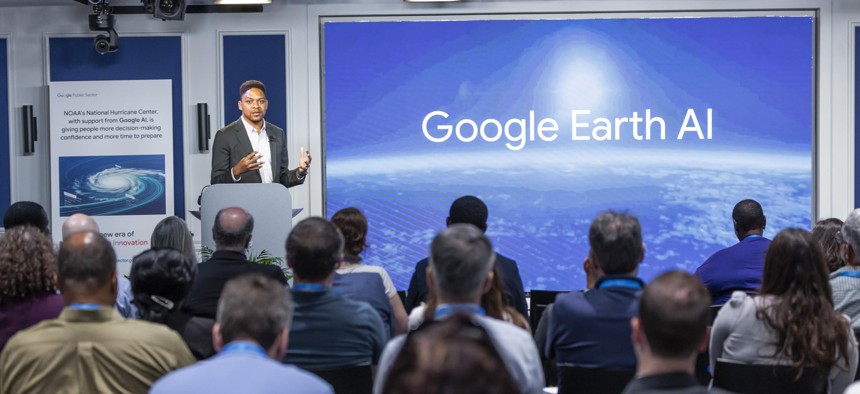
“There’s a lot more opportunity to understand how people are interacting with natural environments, how people are interacting with the built environment and how all those dimensions are interacting with each other,” said Okalo Ikhena, director of product, geospatial analytics and earth AI at Google, speaking at Geo for Gov 2026. “With AI breakthroughs we now have unprecedented predictive power to be able to better understand the future.”
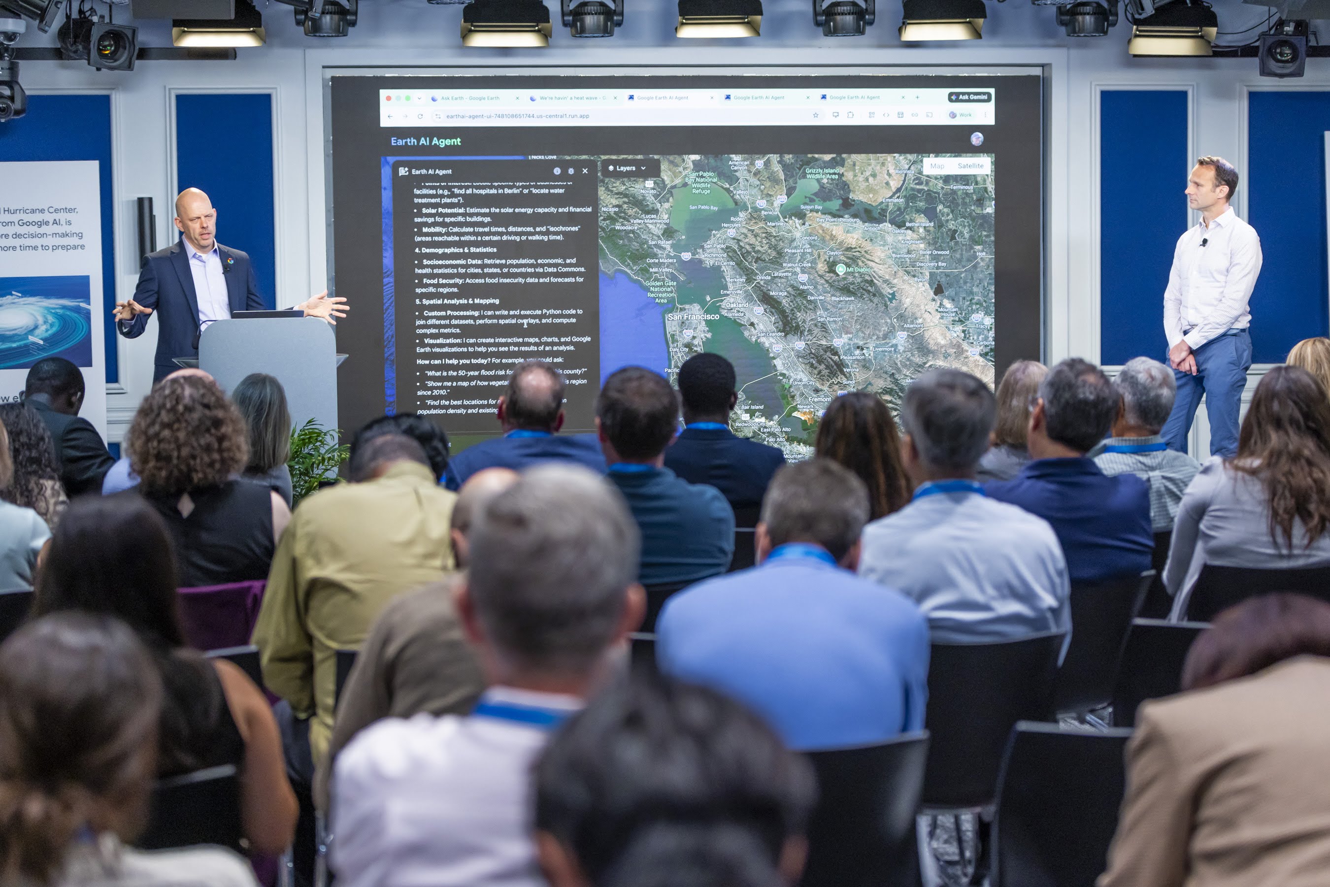
Transforming systems of record to systems of action
The world is changing at a rapid pace, and the ability to operationalize geospatial data is critical to emergency management. During a crisis, such as a hurricane or wildfire, government leaders have a short, critical window for making high-impact decisions about priorities, staffing, communications, and situational awareness.
Historically, these leaders had to piece together their operating picture through various disconnected applications and sources of information. During wildfires in the Angeles National Forest, for example, incident commanders had to juggle five different siloed systems and devices to track a single incident.
“We looked at this operational bottleneck and asked a fundamental question: How might we use AI to visualize and prioritize radio traffic so commanders can see through the noise?” said Jeffrey Ouimette, senior technical program manager at Google Public Sector. “Our response was to blueprint an adaptable environment on Google Cloud that showcases what is possible when modern technology meets that mission-critical need.”
The resulting solution, Google Public Sector’s Mission Resilience Command Console, transcribes radio communications and immediately begins to provide a unified operational picture. It analyzes context and maps out the situation in real time, so an incident commander is able to be fully briefed on a developing situation from their laptop, in minutes, as soon as they arrive on the scene.
AI supports three key features:
- Dynamic task list: As the console transcribes verbal commands, it adds them to a task list so no directive gets lost in transmission or falls through the cracks.
- Geospatial syncing: If a frontline responder shares information, such as a wildfire moving half a mile north, the change will be reflected in real time on the map.
- Priority alerts: Using Gemini sentiment analysis, the system can detect the urgency in a stressed tone of voice and immediately flag the communication as high priority.
“Ultimately, in any kind of disaster response scenario, time is of the essence,” said Stone Jiang, field solutions architect at Google Public Sector. “By taking over manual administrative tasks and providing this geo-aware view of the situation, this prototype allows commanders for any type of crisis emergency response situation to 100% focus on their critical, life-saving decision-making.”
Enabling jurisdictional and cross-agency collaboration
While real-time data saves lives during localized emergencies, day-to-day government operations require breaking down a different kind of bottleneck. A widespread camera system provides real-time data across 26,000 miles of U.S. highways, but the modern challenge is to not only mine that data for insights but to do so in a way that enables collaboration across state and federal governments as well as private industry.
In the state of Maryland, AI is currently being used to ingest and analyze safety data, congestion patterns and the transit infrastructure quality to proactively address hot spots before accidents happen.
“One of the real benefits of the data and AI tools is allowing us to be more proactive, trying to avoid crashes before they occur as opposed to waiting for a crash to occur, and then trying to analyze the causes of the crash afterwards,” said Kathryn Thomson, Secretary of the Maryland Department of Transportation.
In the transportation space, however, siloes persist due to data fragmentation, and often data sharing is stymied by regional borders. Successes like those seen in Maryland aren’t always easy to replicate across state lines.
“The rub is that interoperability doesn’t truly exist between states,” said Seval Oz, assistant secretary for research and technology at the U.S. Department of Transportation. “If you're going on a corridor [across state lines], west, north, south, you can't really hand over information the way they do, for example, in aviation, with a regional sort of handshake.”
A pilot program in Seattle highlighted how differences in responsibility can create walls. While examining how to efficiently reroute attendees after an event, the city wanted to focus on arterial roads that lead to highways, while the state was more concerned about the highways that comprise its jurisdiction. But AI is proving to be the connective tissue, a key to unlocking opportunities for collaboration.
“Now we have tools that cover full metropolitan areas, and we can show that … we can collaborate and actually come up with solutions where the city sees benefits and so does the state,” said Carolina Osorio, research lead of Mobility AI at Google Research and professor of the Department of Decision Sciences at HEC Montreal. “And I think more and more, because these tools are integrating data sets from many different jurisdictions, it is opening the door to say, ‘Actually this is a win-win situation.’”
Democratizing geospatial analysis
AI is also helping to break down siloes in academia, uniting different areas of research toward a common goal. George McLeod, director of geospatial and visualization systems at Old Dominion University (ODU), described a project bringing together spatial modeling and health research to track air quality.
“We take our spatial modeling expertise, which was formerly siloed, their health modeling, which needs the spatial component, and we try to marry those in … [ODU’s] instance of Google Cloud,” McLeod said. “We are working … to build an interconnected system through which we can ingest real-time spatial and temporal environmental data, and then on the back end get an output for the potential for respiratory problems in a certain neighborhood.”
Such unified efforts are contributing to the democratization of complex technologies and data that could previously only be understood by experts. AI, large language models (LLMs), and natural language queries enable non-technical analysts to develop geospatial insights — or put simply, to engage in “vibe mapping.”
For example, imagine a mid-level decision-maker in local government tasked with response-planning related to a heatwave. Using tools like Google Cloud, Google Maps, Google Earth Engine and Gemini, they can surface mobile health clinics and cooling stations, identify where in the city gaps exist that require additional resources, and then find areas with large parking lots to stage those resources.
By asking questions in natural language, they can continue to build their analysis, “vibe-mapping” their way to real-time evidence-based decision-making for disaster response. While this particular use case is still in demo mode, lowering the barrier to entry for geospatial intelligence has significant implications throughout the government.
Rezaur Rahman, CIO, CISO and CAIO for the Advisory Council on Historic Preservation, noted how personnel shortages can stall projects when specialized GIS experts are unavailable.
“If you have a subject matter expert, like an archaeologist or architect, who doesn’t know how to use geospatial data, and that person [who does] is on vacation, now you get these cumulative effects of timelines slowing down,” Rahman said, “because the expert on how to use the tool isn’t there. We’re trying to lower that barrier and to elevate that subject matter expert.”
Lowering the stakes of innovation
As advanced technologies make collaboration easier, solutions more straightforward and deployment timelines faster, they lower the stakes of institutional innovation. When testing a new idea no longer requires months of manual code development, public sector teams gain the freedom to try new approaches.
“The model is getting better. How you interact with the AI model is getting better. … How it handles tools, how it deals with hallucinations is getting better,” Rahman said. “You have to not be afraid to experiment and throw your code away. To me, it's like 30% of the work is going to get tossed out, and I'm okay with that, because there's a better way to do things.”
The speed of research and the rate at which technology evolves is creating an infinite horizon, Rahman added. It’s possible to make continuous improvements, rather than infrequent, discrete and disruptive upgrades — and that lowers the risks of failure.
“Preparation is the ability to build and rebuild very quickly. In the world that we're in, today is the worst it's ever going to be with all these different models and technologies,” Rahman said. “You can build these rapid prototypes … you can shortcut the cycle of feedback with the experts. You have the programmers and you have the experts, now you can bring them together, and depending on how you set things up, you can open things up for them to experiment.”
Learn more about how Google Public Sector is helping shape the future of geospatial intelligence.
This content is made possible by our sponsor Google Public Sector; it is not written by and does not necessarily reflect the views of GovExec’s editorial staff.
NEXT STORY: Beyond the Chatbot: Transforming Government Productivity with Superintelligent AI